Topic starter
I just wanted to highlight the forecaster discussion for my area for mid -week
NEVER SEEN ANYTHING LIKE IT HERE!
Tuesday and Wednesday...extreme winter storm...potentially crippling
with near historic potential. This will be due to a combination of
heavy snow...high winds...producing blizzard to near blizzard
conditions Tuesday night and especially Wednesday. Storm event heavy
snow totals of 6 to 12 plus inches suggested with locally higher
amounts possible.
Tuesday night...snow...heavy at times with some sleet far southeast in the
evening with winds increasing after midnight to 20 to 35+ miles per hour from
northwest to southeast with areas of blowing snow. Travel will become extremely
difficult if not impossible by daybreak with thunder-snow suggested
over most locations. Snowfall rates of 1 to 2 inches an hour and
strong winds to result in near whiteout conditions common by the
overnight hours. Temperatures will begin to rapidly fall toward
daybreak.
Wednesday...prolonged blizzard conditions appear likely over large
areas along and west of the Mississippi River. This due to continued
snow...heavy at times in the morning...diminishing to flurries by
afternoon. All studies show very strong winds of 30 to 50 miles per hour with
some gusts near to possibly over 60 miles per hour suggested. This will result
in near whiteout conditions causing impossible travel conditions most
of the day Wednesday. These high wind speeds likely would also cause
significant...prolonged and widespread power outages. Snow drifts of
3 to over 6 feet deep will be common by late afternoon. Temperatures
will fall into the teens to lower 20s with extremely low wind chills.
Wednesday night...winds to decrease to 10 to 20 miles per hour by midnight but
deep drifts may keep most roads closed. Have trimmed lows and
with clearing skies and deep snow cover...mins below zero appear
plausible.
WOW! This is one time when you really hope they do get the forecast wrong!
<img src="http://weathersticker.wunderground.com/weathersticker/big2_cond/language/www/US/IA/Fairfield.gif" alt="Click for Fairfield, Iowa Forecast" border="0" height="60" width="468" />
Posted : 06/12/2009 1:05 am
That is really HARSH man, I hope there wrong too! Here's an idea. Should you run some long ropes over the top of your cacti hut to try and keep it from going haywire if you have 60 mph winds? Just a thought, I'd hate to see something happen to them. I'm sure you have enough on your mine right now. I'm going with there going to be wrong!
Bill
Posted : 06/12/2009 4:48 am
Jim,
I'm following this one, too, as it will be so big as to hit me as well as you. The local meteorologists are still unsure how it will play out here. As of this morning, the prediction was snow in Kansas and cold rain here turning to snow late but they admit they are just not sure.
I have to work late Tuesday (until 9pm) 20 miles from home, so I have that to think about as well as my poor palms.
I have a thread on "winter protection" and if you can offer this novice some quick tips I'd appreciate it. I'll be busy with work tomorrow, so if I do anything different before Tuesday's storm, it will have to be today.
--Erik
Posted : 06/12/2009 5:25 am
Here's our predicted week... Considering that Geraniums etc. were blooming until this weekend, I'm not looking forward to it!
At least there's no cold rain forecast!
High -1°C 4°C -1°C -4°C -4°C -4°C
Low -4°C -1°C -6°C -7°C -8°C -10°C
Posted : 06/12/2009 8:34 am
Topic starter
Looks like this storm is hitting California right now but I don't think it bombs out until it crosses the rockies.Here is the latest advisory,with any luck the snow we got last night 1-2"will melt a little and freeze some of my protection down a little more solidly-The area around Ottumwa and Highway 34 is where I live-Yikes!
Overview...minor changes to current package except upgraded west-northwest 1/2
to 2/3 are for blizzard watch as blizzard conditions will overspread
at least all this region after midnight Tuesday night and through
most to all of the day Wednesday. Thunder-snow also evident moving
into area Tuesday night over most or all the region. Snow event
amounts of 6 to 12 inches remain on tap with locally higher amounts
of 12+ inches...locally up to 15 inches suggested +/- 40 miles of a
Freeport to Iowa City to Ottumwa line. This system remains on track
to be one of the most significant high impact events in this area for
several years...if not longer.
Tuesday...have upped probability of precipitation with snow overspreading all area with snow
amounts of 1 to 4 plus inches by evening. Heavier snow may arrive
in far SW section late PM that later shifts may need to up totals
as lead vorticity maximum may be stronger than current solutions indicate. NE
winds of 10 to 20 miles per hour should limit snow to just minor drifting
until later. Along and south of Highway 34 still suggests snow...
mixed at times with sleet. Local analysis suggest most precipitation
should still be snow.
Tuesday night...a wild night with snow...heavy at times with thunder-
snow and winds increasing from northwest to southeast. Local tools show 1 to 2
inch snowfall rates remain plausible. Some suggestion of internal
Gravity waves may result in gusts at or above 40-45 miles per hour that would create
brief whiteout conditions for later shifts to consider. Blowing snow
and areas of blowing snow to occur over all but far east sections
that will render travel conditions difficult if not impossible by
daybreak. Most of the heaviest snow will occur in this period.
Wednesday...extreme winter storm will result in large periods and
areas of blizzard conditions...potentially crippling the area. Over a
dozen tools indicate sustained winds at least of 25 to 40+ miles per hour with
gusts of 50 miles per hour or more. Sustained winds of 30 to 45 miles per hour appear
quite probable with some gusts to ~55-60 miles per hour. A vigorous deformation
zone should remain from dbq to near brl that will lift NE toward middle
day. Widespread and prolonged power outages based on past snow
amounts and wind speeds appear likely. Temperatures will fall
throughout the day into the single digits to lower teens by dusk.
Snow to diminish to flurries but with blowing snow will be hard to
ascertain the difference until late afternoon many locations. Snow
drifts of 3 to over 6 feet deep will be common by late afternoon.
Combine this with periods of whiteout conditions will make travel
conditions difficult at best to impossible with life threatening
conditions possible due to very low wind chills below zero(F) by
afternoon.
<img src="http://weathersticker.wunderground.com/weathersticker/big2_cond/language/www/US/IA/Fairfield.gif" alt="Click for Fairfield, Iowa Forecast" border="0" height="60" width="468" />
Posted : 07/12/2009 7:54 am
Oh my Jim 🙁 That sounds like it could be a major pain in the ass! I hope all of your stuff is ok, sounds like worst case scenario at least if you lose power everything will be buried under snow. Winter really Sucks when storms like this come around.
Best of luck!
Bill
Posted : 07/12/2009 8:23 am
Topic starter
Yea Bill
If the power does go out the stuff inside will be in more trouble then the stuff outside 😯
The temps should stay above freezing in the enclosures
with a good coating of snow(provided the enclosures are still enclosing the palms 😯 again with the shock face)as the ground temps should help out there.
🙂
<img src="http://weathersticker.wunderground.com/weathersticker/big2_cond/language/www/US/IA/Fairfield.gif" alt="Click for Fairfield, Iowa Forecast" border="0" height="60" width="468" />
Posted : 07/12/2009 8:37 am
Topic starter
We have already had about 4" and the storms not here yet!
There is an interesting term in the latest forecast that I have never heard before,see if you can find it.
Well heres the latest info out this morning.BTW.i live in Fairfield-
Short term...today and tonight...
all indications remain on track for a high end...high impact major
winter storm with potential crippling weather impacts.
Today...have kept highs upper 20s northwest to lower 30s southeast with 1 to 5 inches
of new snow. Snow should fall most of the day with heavy snow
moving into far south sections toward daybreak. East to east
northeast winds of 10 to 20 miles per hour should only cause minor drifting
of snow. The snow will accumulate on most roadways as surface
temperatures remain near to below freezing. Sleet will mix in with
the snow this afternoon southeast of a Princeton to Galesburg to
Burlington to Memphis line. Even in these areas...thermal profiles
suggest the heaviest precipitation there should still fall mainly as
snow.
Tonight...on track for lots of snow...some thunder-snow and then
lots of wind after midnight. Only minor changes made as American
models and even other models support a rapidly deepening...closed
system with favorable profile for thunder-snow over at least southeast
1/2 to 2/3. Snow accumulation rates of 1 to 2 inches an hour...combined
with increasing winds with risk of Gravity waves with wind gusts
of 35 to 45+ miles per hour...will make for near whiteout conditions at
times...mainly after midnight. Heaviest snow should fall +/- 40
miles either side of a Freeport to Cedar Rapids to Chariton Iowa
line. Locations along and north of a Sterling to Moline to Memphis
line will likely have at least 8 inches on the ground with 10 to
12 plus inches on the ground along and north of a Montana Carroll to
Fairfield axis. Far south southeast sections will have 4 to 9 inches on
ground by daybreak.
Objective metrics indicate this system will fall into the 3.5 to 4.5
sigma range for intensity. This is near record to record territory
mainly supporting lots of wind. ..Nichols..
Long term...Wednesday through next Monday...
intense winter storm will move northeast across the Great Lakes
Wednesday. European model (ecmwf)/Gem have been by far the most consistent for nearly
5 days now. Both indicate a deformation zone across the area at 12z
Wednesday with the back edge roughly along the Iowa/MO border. Thus
accumulating snow will continue through the morning before starting
to shut down in the afternoon. Temperatures will fall all day from a
high right around sunrise.
This storm is impressive. Snow amount wise...it has been about 10
years since snows of this magnitude and expanse have been seen.
Storm strength is another matter. Based on the current forecast of a
980mb or better surface low...it has probably been 20 to 30 years since
a winter storm of this magnitude has been seen in the area.
Winds will quickly increase across the area Wednesday morning. The
models have trended wind speeds lower. However...the models do a
poor job of handling or incorporating non-adiabatic processes and
isallobaric winds. Thus the winds will be higher than forecast by the
models. The models have been very consistent in indicating 25 to 30
mb of gradient across Iowa for this event. The 00z runs are pushing
30 mb. Therefore...sustained winds minimally of 25 to 40 miles per hour with
gusts likely north of 50 miles per hour should be seen. Winds of this magnitude
will produce whiteout conditions.
Snow to end Wednesday evening and winds will gradually diminish.
There is a good chance that headlines will need to be extended into
Wednesday evening. Since this is a highly nonlinear event...will
defer the extension to the next shift. The current blizzard watch
will remain in place. The models continue to trend stronger so the
true magnitude of this event is not yet fully known.
NEVER HEARD OF GRAVITY WAVES BEFORE!
I had to look that one up.
It sounds like there is the potential for the atmosphere/wind to crash like a wave!
I just hope my covers hold!
<img src="http://weathersticker.wunderground.com/weathersticker/big2_cond/language/www/US/IA/Fairfield.gif" alt="Click for Fairfield, Iowa Forecast" border="0" height="60" width="468" />
Posted : 08/12/2009 7:49 am
Never heard of Gravity Waves before... I looked it up too, but I'm not sure I understand what exactly it means. Maybe some young weather-person thought it sounded cool, so they stuck it in there!
http://www.tiimes.ucar.edu/gw/documents/gw-WhitePaper.pdf
Tell you what, you keep those gravity waves down there, and I'll stop questioning all the 'experts' on the classification of Trachycarpus... Do we have a deal?
Posted : 08/12/2009 8:13 am
Good luck Jim!
Here's the Kansas report.................
* ACCUMULATIONS: STORM TOTAL AMOUNTS COMMONLY FROM 6 TO 12
INCHES WITH LOCALLY 15 INCHES ALONG AND NORTH OF A LINE FROM
HERINGTON TO OSKALOOSA...3 TO 6 INCHES SOUTH OF A LINE FROM
HERINGTON TO OSKALOOSA.
* WINDS: WILL INCREASE AND BECOME NORTHWESTERLY AT 20 TO 30 MPH
WITH GUSTS TO 40 MPH THIS EVENING...CAUSING BLOWING AND
DRIFTING SNOW...VERY LOW VISIBILITIES AND DROPPING WIND CHILL
VALUES INTO THE MINUS 5 TO MINUS 20 DEGREE RANGE.
Steve
<a href="http://www.wunderground.com/cgi-bin/findweather/getForecast?query=zmw:67484.1.99999&bannertypeclick=wu_clean2day"><img src="http://weathersticker.wunderground.com/weathersticker/cgi-bin/banner/ban/wxBanner?bannertype=wu_clean2day_cond&pwscode=KKSSALIN9&ForcedCity=Tescott&ForcedState=KS&zipcode=67484&language=EN" alt="Click for Tescott, Kansas Forecast" height="100" width="300" />
Posted : 08/12/2009 9:31 am
Topic starter
It looks like they are similar to outflow boundaries in thunderstorms only they begin at the top and possibly pull down jet stream winds like a crashing wave.
Good luck Steve,looks like you may have some Gravity waves in you back yard!
See if you can sell them on e-bay!
It is a cool sounding term until your $h*% gets blown over!
Paul
I have no control over your G-waves up there but I do like the sound of the second part of your deal 😀
We have been having some fun with that term all day!
Until the G-waves hit it's all fun and games-until someone loses a fortune-I
<img src="http://weathersticker.wunderground.com/weathersticker/big2_cond/language/www/US/IA/Fairfield.gif" alt="Click for Fairfield, Iowa Forecast" border="0" height="60" width="468" />
Posted : 08/12/2009 9:50 am
Topic starter
The worst of the snow missed us to the east as some "warm air"was pulled into the dry slot of this storm.
Last night I watched the low jump from the pan handle of Oklahoma and reform over Missouri in 30 minutes,unbelievable!
This is when the storm really bombed out!
The pressure dropped to 982mb(they were predicting 980)it may have even gone lower,this was as of 4am this morning.
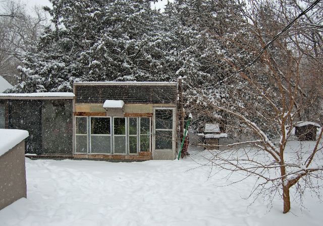
As I said the bulk of the snow missed us,(I believe places just east may have received 10-20")we got 5-6" of the heaviest snow I can recall shoveling.
I could hardly lift a shovel full.
We are getting 25-50+mph winds.
The weight of the snow almost collapsed my largest hoop/green house.
I had to double brace it as one side fell in.
The g-house and everything else is pretty frozen/weighted down by all the snow and ice-
Good deal,they didn't blow away!
All the g-houses(big and small are remaining in the 30(F) range because of the insulation provided by the snow,
so I may not need to heat tonight in spite of possible sub-zero(F) temps.
The Washy shelter is doing great and is staying in the high 50s(F) although it was not my original plan to cover them the way I did!
So far so good!
<img src="http://weathersticker.wunderground.com/weathersticker/big2_cond/language/www/US/IA/Fairfield.gif" alt="Click for Fairfield, Iowa Forecast" border="0" height="60" width="468" />
Posted : 09/12/2009 7:58 am
Thanks for the update--I've been worried about you.
Did you lose power? I was out but only briefly. I hear on the radio (NPR) some parts of Iowa have had more trouble.
Posted : 09/12/2009 8:02 am
Topic starter
It's on!
<img src="http://weathersticker.wunderground.com/weathersticker/big2_cond/language/www/US/IA/Fairfield.gif" alt="Click for Fairfield, Iowa Forecast" border="0" height="60" width="468" />
Posted : 09/12/2009 8:05 am
I'm happy to hear that.
As a novice, that is something I worry about. I used heat tape and jugs of hot tap water (electric water heater) last night and it worked--temps in shelters bottomed out at about 0 oC/32 oF despite air temps of 17 oF and strong winds.
However, in December, 2007, we were without power for a few days in sub-freezing weather. So, what do you do in that situation?
Posted : 09/12/2009 8:13 am
Page 1 / 2 Next
